Tuesday, June 2, 2020

Little Bear Peak Snow Climb - 48/58

In early May a CMC ski friend, Kristen, contacted me about skiing a 14er in the San Juans. I didn't think the snow would be very good on the easy route and the harder route was probably over my head since I haven't skied since March. She agreed and liked my idea of snow climbing Little Bear - what's generally known as the most dangerous Colorado 14er. The standard route ascends a narrow couloir with a funnel covered in baseball to bowling ball sized rock. Any rocks kicked down by climbers or mountain goats above are sent hurtling into the couloir and onto the climbers below. I had been wanting to climb it this time of year since there are fewer climbers on snow routes and the snow would reduce some of the rockfall. The governor had just given his okay to travel for "camping" as long as you don't spent time in the communities you travel through and plan ahead and Little Bear is in Alamosa county which has been applying for exemptions from the state COVID restrictions so we didn't feel unwelcome. 

I met Kristen and we took her Xterra down - turned out to be the perfect vehicle for unrelenting rocks on the infamous Lake Como Road. In the right truck it really wasn't that bad, especially after airing down her tires to ~22 psi. This is a step most people miss when driving really rough roads; soft tires absorb bumps, conform to rocks to add traction and prevent sharp rocks from flatting the tire. You don't spin your wheels losing traction as much and can crawl more easily over difficult obstacles. It was mostly just rocks big enough to prevent a typical cross over from making it very far. We parked at 10,000 feet where the 14ers.com trailhead description said to park but could have made it another half mile. The hike in was slow, loaded with overnight packs, cold weather clothes, ice axes, crampons, etc. but we caught up to a local family out for a drive and day hike and chatted with them some.


After 2.5 miles and about 1800 vert, we made it to Como Lake and found a site for the night in between snow drifts. The next morning we were hiking by 5:45. The route is fairly straight forward - ascend the snow filled North Gully, traverse along the ridge under the hourglass and then up to the summit. The lower half of the North gully was filled with rotten snow and it really slowed our progress. About midway up the snow was supportable and we were able to climb out to ascend to the hourglass.


The terrain above the hourglass was loose but not in a way that made me afraid of falling, just incredibly aware of how easy it was to send rocks down at frightening speeds. I was glad we were the only ones on the route but was still careful not to kick anything down on Kristen. We made it to the summit after nearly three and a half hours for a distance of 3.5 miles. 


Soon we were descending and post-holing our way back to the tents. The route was so steep there was no real way to glissade anything so we ended up downclimbing, facing into the slope and using both axes for balance when the inevitable thigh deep plunge through rotten snow occurred. Eventually we were back at the tents for a short break and to pack our things for the walk out and long drive home. 


Tuesday, May 5, 2020

Long overdue update - 1-year post breakup in the pandemic

It's been a while since I updated this blog - sorry!

I'll try to sum things up since the last post in 2016.


2017 I got more into backcountry skiing and even bought a touring setup, took my avalanche level 1 class and continued to bag peaks - still not a great skier but it was fun learning.  Guthook and I did most of Skurka's Wind River High Route as part of our now annual backpacking trip. Maybe I'll write a blog about it but the route was incredible and more difficult than we expected. Training was tough as a working stiff, especially with a big project I had at work that required a 10-day on 4-day off schedule with 10-12 hour days when on. Guthook had some altitude problems but we ended up doing most of the route, just taking a shorter exit.  Rachel and I had done a 4th of July weekend trip to the famed Chicago Basin to bag 14ers. The scenery was incredible and I got all the peaks - class 3/4 isn't Rachels cup of tea so she explored some trails in the area. We had a wonderful time. I think that was the year we did the Wonderland Trail too, 95 miles around Mount Rainer only we had no visibility the first five out of seven days. The last two were great but it was a bit anticlimactic and really made me appreciate Colorado - a state where I've never been skunked for more than one day at time.

2018 saw even more skiing - at this point Rachel was a proficient backcountry nordic skier and we had some good trips, a hut trip or two with P. Mags and even a few day skis with the CMC. I bagged more 13ers and 14ers over the summer - I think this is the year a friend from Boston, Matt, moved out and we did some hikes together including some easier 14ers in the San Juans with Rachel. In September we moved into a townhouse I bought in Lakewood. We had been in Boulder the last few years so it was a big change but it was great living together those first few months - painting and picking out furniture from craigslist. The space is really nice and I started to think we would be together for a long time. It was closer to both our jobs and the neighborhood definitely isn't Boulder but there are lots of trails nearby. 

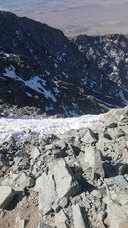
That January I was skinning up Quandary Peak, a local 14er, with two friends on snowshoes. The nearby ski area reported a foot of snow overnight but we found less than 6-inches of new snow covering rocks. I was debating walking down with my friends if it came to that when we spotted a lone figure crumped near the base of the ski line most people do on the east face of the summit. We called out to two people who had went over to check on the skier to see if they needed help - one of them replied they needed bandages and had called 911. I went over to help since my first aid kit is pretty good but when I made it there and started to dig through my pack the victim stopped breathing. I could tell from his tracks he had skied at high speed into some snow covered rocks and tumbled into them. The other two responders had covered his head wound with a wool mitten and I didn't want to look so we got him into a stable position and started CPR. More people stopped to help but I was the only one trained in CPR and a second 911 call brought in flight for life about 20 minutes later. The paramedic assessed the head wound and said he could have landed in the ER and not survived. The group was pretty devastated but we helped move his body and gear to the helicopter. I was shaken for a few weeks but eventually returned to skiing.

2018's annual Guthook trip was a pretty moderate on-trail affair with Rachel in the Elks since we were all out of hiking shape. It was a variation of the Capitol Pass loop and was incredible - honestly better than the 4-pass loop Rachel and I did earlier in the year. I decided to start a 4WD trailhead for fun and we took Rachels 2000 Ford Ranger, which did great. It rained way more than forecasted on our last day and the roads got slick. Drenched and finally back to the truck we decided to take another route out which turned out to be an extremely challenging 4WD road for a stock pickup - big rocks, some drops and lots and lots of bumps. Still, I think it was safer than going down wet switchbacks cut into slippery shale. Rachel was not happy when I told her about the paved trailhead a few miles off the loop we could have used... Also her brake caliper loosened up on the way out, I must not have torqued it properly when changing the pads and rotors a month prior.

In the fall my work sent me to Hawaii for two days of actual work that just happened to fall right before a weekend... Of course I took Rachel along, we loved the beaches and snorkeling but something seemed off. There was no romance and it kind of felt forced. We were both kind of testy most of the trip. I was worried about our relationship but thought it was stress from both our jobs and hoped things would improve. Neither one of us were very good at communicating - I would ask Rachel what was wrong and she would say she was fine but I knew something was off just not how to get at it. 

In 2019 I finally started to feel proficient at downhill and especially backcountry (alpine touring) skiing. We spent a lot of time skiing resorts and I got some backcountry days in with some Colorado Mountain Club friends but in late March things between Rachel and I still weren't feeling right. I got some birthday money from my parents and we decided to go for a long weekend skiing in Banff since our ski pass had 5 days at three different resorts near there and it was only a 90 minute flight from Denver. They weren't having a great snow year - it was pretty much spring conditions but the scenery was incredible and it was fun to ski somewhere different everyday. Again though things felt kind of forced and when we weren't skiing it just didn't feel right. After that trip I was starting to think about breaking up and what that would look like but after four years of basically being attached at the hip it was hard to imagine. We still couldn't communicate. I had put on some weight and thought maybe I wasn't attractive anymore or was doing something wrong but couldn't get a straight answer. There was just this air of anxiety hanging over everything.

Around the end of April, Rachel started sleeping in the guest bedroom. At first it was because of my snoring but I knew that wasn't right because the week before she wouldn't snuggle like we used to - it seemed like things were going downhill rapidly. The third night in a row I said it felt like we were becoming room mates and asked if she still loved me - I got a silent hug in response. A few minutes later, in tears, Rachel came out to me as gay. She said she had known for a while but thought I would be mad if she told me. I wasn't mad at all, which kind of shocked her. I was actually relieved because finally the answer to why things were feeling so wrong was out and it wasn't anything I had or hadn't done. I wish she had told me sooner, my guess is she knew when we went to Hawaii the previous November but maybe was in denial for a few months.

It took until she moved out about two weeks after she came out to me for the breakup to really hit home. When you wake up and the person who had been next to you for four years isn't there, it's kind of shocking. Going to bed wasn't much better - I just kept thinking about what I had lost; adventure buddy, partner, best friend - someone to grow old skiing with. I cried a lot those first few weeks. I would start to feel normal again and then feel worse when something reminded me of Rachel. A mutual friend was training to thru-hike the PCT so we did some short backpacking trips together the month after the breakup and just setting up the tent almost sent me to tears - it was something Rachel and I had done together literally hundreds of times. Once inside the tent, alone, she was all I could think about. Backpacking in general has been tough for me ever since, always bringing Rachel to mind.

Over the rest of that summer and the fall I tried to re-kindle a friendship from Rachel but I got nothing in return. Each time plans got canceled without any offers to reschedule or invitations to try again I suffered with self doubt and uncertainty as to why . Eventually I suspected she wasn't interested in being friends and a few misunderstandings later, some shitty things said on my part and we aren't talking to each other anymore. Time to move on for good I guess.

Anyway, enough about Rachel. In the fall of 2019 I joined a 20-person ski house-share in Silverthorne. Having a bed with my name on it made skiing so much more enjoyable: no more 5 am drives to beat traffic only to ski all day wondering how bad traffic would be. I also met a bunch of new friends who liked to spend time in the mountains.  Colorado was having a great ski season and having a place to stay meant I could come up during the week, ski in the morning and get into work around noon. The house was rarely busy and despite the 19 other people on the lease there were usually 7 to 10 people there on weekends and 1 or 2 during the week. At $200/month it was definitely added cost to the ski season but it saved me so many hours in traffic between ski areas and home and let me meet more people - something everyone needs after a big breakup.

Right at the end of February I bought a truck! I still have my Honda civic but plan on selling it when the market picks up. The truck lets me drive over unplowed trailheads, 4x4 roads and be able to bivy in the bed. The previous owner bought a matching topper and built a simple platform with storage box underneath. In winter I've been getting around 21 mpg highway so not too terrible. I wanted a vehicle I could sleep comfortable in, could access moderate 4x4 roads with and didn't take premium or eat too much gas. A lot of people would have gone with a larger Subaru but their engine quality has seriously declined to the point where corporate claims 1 quart of oil burned per 3,000 miles is "normal". Plus, they CVTs and non-turbo engines are anemic. If you get a turbo version the mpgs go from around 35 to 28 or 29 and you have to use premium - basically a 25% cost increase in gas so it costs the same as a 22 mpg vehicle. Even then the ground clearance isn't great compared to a truck and there's no 4-low to crawl up and down rough terrain. I would up getting a 2015 Tacoma SR5. Not the offroad version with the locking rear diff and A-TRAC all wheel traction control but I think plenty capable - especially given the places I was able to get Rachels Ranger with open diffs, smaller tires and no traction control at all. I swapped in some LEDs to the interior lights which make a big difference and swapped the worn suspension out for some take offs from a 2019 offroad Tacoma, giving my 2015 about a half inch lift and a softer ride.


March came though and COVID-19 hit Colorado hard. Vacationers to ski areas from out of state started outbreaks in Vail, Gunnison and Denver. The Governor shut the ski areas down with no warning. Suddenly there were talks of ventilator and PPE shortages, skyrocketing caseloads and overwhelmed rural hospitals serving a vulernable elderly population. Vail sent all their employees packing; potential vectors back to their home towns. Rocky Mountain National Park closed, then the ski areas closed their uphill access. There were no travel restrictions yet and the national forest was still open so I and a few friends still went out skiing - we had two weekends of fantastic powder, some of my best backcountry days to date. 

In mid-April I learned of another backcountry ski fatality. I have always followed accident reports through the Colorado Avalanche Information Center (CAIC) as a way to learn from others mistakes. This time though, the report was about someone I knew - Aaron, from the ski house. We weren't close but had skied at Copper together once and hung out at the house a lot, discussing avalanche conditions and decision making. Aaron and two friends went out to ski an incredibly exposed, narrow and aesthetic couloir or snow filled gully. It was several days after a significant storm and a few inches of snow fell the previous night. The party didn't expect a significant wind slab problem and confirmed their beliefs with some intentional ski cuts above the entrance to the couloir. When the third skier joined the other two he set off a thin wind slab avalanche, only 8 inches deep but enough to knock Aaron off his feet and send him nearly 2,000 feet down the couloir to his death.  

The backcountry and ski house community was shocked - why had they been out there during the pandemic? What made them think that north facing line was safe? Aaron was a mentor to several people and considered a highly capable backcountry skier, one more capable than me or most people I know - and he died. It came as shock both from the loss and the realization of how dangerous backcountry skiing can be. For me it was an affirmation of the choices I make to ski conservatively, avoiding no-fall zones and conditions that could lead to a fall on steep terrain. I would rather ski fun slopes in good conditions and turn back more often than I need to than push boundaries and ski steep exposed terrain like many others. The death of a better, more experienced skier was just another reality check and helped ground me to avoid that kind of terrain.

When the order to socially isolate came, I stopped doing anything with other people entirely. I was kind of glad to have gotten a renter/housemate back in July since I wouldn't be totally alone. I still went out to nordic ski on closed roads and snow covered trails since it's so low risk and kept me sane. Around the end of April the snow started getting too icy to be fun for skinny nordic skis and floppy boots. I finally got my parents to ship out my old Bilenky road bike and put some money into new tires and some work into the drivetrain to get it running.  Road biking was a passion of mine from about 2006 to 2010, ending in a persistent knee injury. The quiet roads from social distancing have been fantastic to ride on and a bunch of my neighbors and coworkers are roadies to boot. I know - social distancing - but do you really think you can transmit a virus between people moving on bicycles? I don't so I'm not going to worry about it.

I've found some quiet trails to hike as well and have been wearing a mask when hiking past people although I think even that is a bit much. I even got a mid-week backpacking trip in without leaving my county! Reynolds Park has hike in campsites available for reservation through Jefferson County and nobody else was there during a Wednesday night outing last week. At a half mile each way I think it was my shortest backpacking trip to date but was a great change from my house. I had the whole place to myself and plan to go back when at the next new moon to see some stars.

Planning the year with COVID is going to be difficult at best and futile at worst but I still have the following goals:

  1.  Finish the 14ers - I have 11 left
  2.  Bag at least 5 more centennial 13ers
  3.  Finish the Colorado Trail - I have about 80 miles from Durango to the CDT left
  4.  Explore new parts of Colorado - this one is intentionally vague if restrictions are in place all summer
  5.  Do another trip with Guthook somewhere awesome - also going to be hard to plan and likely to be put off until Fall
  6.  Keep making new friends
In addition I'll be mountain biking, hiking and even road biking during the week and weekends when I'm not supposed to travel. I'll try to keep this blog updated and see how I do.


Saturday, July 23, 2016

Sangre Scramblin' - Peak Bagging in the Blood of Christ Mountains

Ever since hiking in northern New Mexico and looking east to their enormous, craggy and snow capped peaks I have been curious about the Sangre de Christo mountain range in southern Colorado.  It just so happens Guthook hit me up to see if I wanted to get in a backpacking trip in Colorado in mid-July.  I agreed and had already worked out part of the route, the remainder was pieced together using descriptions and maps from summitpost.com and 14ers.com.  Soon I had developed a long loop, almost entirely off trail and requiring a bike ride to get back to my car at the end as Guthook was flying in.  The trick was that the daily mileages were so low but the elevation gain never dropped below 4,000 feet per day, and all above 12,000 feet.  We would need strong legs and good weather to get this done.  Not only that but Guthook lives at sea level in Maine, so I had to keep altitude sickness in mind.

Approaching Venable Pass up and to the right.
He flew in late on a Wednesday night and of course my phone didn't ring when he called because I left it on night-time mode.  That led to me realizing at 3 AM that he was shivering at the bus station. Woops, sorry Guthook!  The next night we left after I finished work and we ended up car camping at 9,000 feet near Poncha Pass about an hour from the trailhead.  After breakfast in the incredible hippy town of Crestone we stashed the bikes at the southern trailhead and made our start around 9:30 AM from the northern trailhead.  In front of us was a mosquito ridden 5,000 foot climb to the top of Venable Peak which we reached after some easy class 2 hiking up from Venable Pass.  From the ridge we could see smoke churning into clouds from the Hayden Pass Fire - a 12,000 acre wildfire about 15 miles north of us.  It was an incredible but somber sight.
Smoke mixes with clouds.

From the top of Venable Peak we tried to identify the route ahead and could spot 7 of the 10 peaks we had on the menu.  On the way down we encountered a group of 14 (!) backpackers taking 5 days to do the loop that we had just done half of in 7 hours.  Their packs were of the extra-extra large variety but I'm sure they had a great time in camp.


Climbs not pictured: Horn Peak, Broken Hand Peak and Obstruction Peak.
Soon we dropped down the adjacent drainage and found a breezy camp a little below 12,000 feet to keep the mosquito's off.  We had to eat dinner at the lake and haul water up for the next day since we had no sources to count on along the crest of the Sangres. Guthook had a mild head ache but no issues with the altitude so far.  The view from our tents wasn't too bad to boot.

The west side of Comanche Peak lit up at dusk.
The next morning we climbed the ~1,000 or so feet back up to the pass, turned left off the trail and ascended Comanche Peak, our second 13'er (peak higher than 13,000') of the trip.  Ahead was a false summit and a broad flat area north of Fluted Peak.  The ridge to Horn Peak loomed to the west, branching off fluted's false summit and we went back and forth about whether to climb the 2 miles out and back, losing 500 feet and gaining 800 in the process.  In the end we bagged it and enjoyed our first real "Class 3" scrambling of the trip.  It was a good warm up for the Class 4 we encountered on the ridge between Fluted and Adams.

Fluted Peak in back, Adams is behind me.
Guthook exiting an exposed Class 4 chimney on the way to Adams.

This was not the thing you want to do with a heavy pack, every pound tugging you backwards and sloshing around when you make a quick move across a potential 1,000 foot fall.  The climb up Adams had four intimidating ribs jutting out along the ridge, each of which presented a vertical wall of rock with a chimney along the back side or some other way of negotiating it. We managed to make it to the summit without vertigo or death and descended the much simpler standard route to camp above Willow Lake.

Guthook contemplates the summit of Adams.

Dusk gives the Sangres their name as Challenger and Kit Carson glow red in the fading light.
Another breezy, almost mosquito'less camp.
The next morning we finished the descent to South Colony Lakes and joined up with the standard route up Challenger Peak - our first 14er and 6th summit of the trip.  We both hated the route - straight up a dusty and loose rock ridden slope with little solid rock until the top.  Fortunately no other climbers were immediately ahead of us, so the risk of a rock to the head was low.  We did meet a few on the summit who took our photo though.

Summit of Challenger Peak.
I printed our route descriptions and photos of the way to Kit Carson, down Challenger's ridge and around "The Avenue" but it was all fairly obvious and well cairned.  At the summit of Kit Carson we began the descent down to a Class 4 traverse across its East Ridge which was the most sustained and enjoyable scrambling of the trip so far.
Guthook head up to Columbia from Kit Carson.


Easy, right?
Soon we had the summit of Challenger and another cairned and well trodden path around it leading to a view of Obstruction Peak and the "bears playground" - a huge flat grassy ahead.

Ridge to Obstruction Peak - our 4th 13,000'+ peak that day.

Bears Playground with Crestone Peak in back.
At this point clouds were rolling in so we had to hoof it.  After another class 3 ridge traverse we made it to the saddle below Humbolt Peak and decided to call it a day.  It was 2:30, the weather was iffy and we were both almost out of water.  Our fourth day was unplanned and had several options so we decided to regain the ridge, bag Humbolt (our 3rd 14er of the trip), descend and go up Broken Hand Pass to Broken Hand Peak.  Yet again, we found a beautiful campsite, but with some big horns as a bonus.


The next day went as planned, although the trail up Broken Hand Pass turned into more of a scree scramble at the top.  Again, we didn't have anyone above us which made things a lot safer.  We were both totally exhausted but made the slog up Broken Hand Peak for our 11th summit of the trip. The descent back was uneventful and we found another epic campsite.  The tents came up minutes before the rain and a thunderstorm rolled in.

Summit of Broken Hand Peak looking towards Crestone Needle.

Another pleasant site.
We got up a little earlier the next morning hoping to outwit the mosquito's but were severely disappointed when clouds of them chased us down the trail.  For over two hours I killed at least a mosquito every 5 seconds, totalling over 1,000 blood suckers.  I still came home with several dozen mosquito bites since we neglected to bring any bug spray.  Oh well.  The trail down Cottonwood Creek was difficult to follow until we were below treeline but soon became a beautiful waterfall riddled thing with open granite ledges (and more mosquito's).  We got back to the bikes only to find one had a flat tire so I booked it back to the car, changed and came back for Guthook (and my other bike...).

All in all, an epic trip.  34 miles, just under 20,000 feet of elevation gain and descent.  For reference, in New Hampshire's steep white mountains a pemi loop is about 33 miles with 10,000 feet of gain.  This trip was double the climbing and nearly all of it was between a lung gasping 12,000 and 14,000 feet.

Wednesday, December 2, 2015

CDT - Thoughts and Advice for Future Hikers

The CDT seems to be the most feared of the triple crown trails, and usually for good reason.  It's far more remote than the AT, more rugged than the PCT and at first glance seems to be over 3.000 miles long.  However, there's an increasing amount of useful information out there for the trail but not a lot linking it all together.  This post will put together what most thru-hikers did in 2015 and what I would have found useful before hiking.

Disclaimer: Rachel and I only hiked the northern 250 miles of New Mexico in the spring, flipped to Glacier, hiked all of Montana/Idaho, the northern half of Wyoming (including an alternate in the Tetons) and all of Colorado - about 2200 miles in total.

I really enjoyed *most* of my time on the divide but Rachel and I also section hiked and skipped the roadwalks and less liked areas.  Unlike the PCT if you carry the right maps and you can choose your own adventure instead of doing the same thing as the other thru-hikers.  The trail tread, maintenance and marking varies every day so you never know what you're going to get unlike the consistent sidewalk of the PCT.  You spend a lot of time above treeline with great views, the trail never got incredibly hot and although water was always on our minds we rarely carried more than 3 or 4 liters.  We had more storms than my PCT hike and several times had to bail off the divide for half a day or take a lower route because you're so exposed for so long.  The logistics of the trail can be frustrating and there are some very long dirt and paved road walks but I think it's a great trail.


The best parts of the trail for me were Glacier National Park, the Anaconda-Pintler range and most of the Idaho-Montana border, Knapsack Col and Cirque of the Towers in the Wind River range, the alternate through Teton National Park, basically all of Colorado and the stretch north of Ghost Ranch in New Mexico.  That's actually most of what we hiked, aside from central Montana, parts of Yellowstone and some dull but nice trail in New Mexico. 


PCT vs CDT


A lot of people seem to come to the CDT expecting a lot, usually a more rugged version of the PCT.  Most of those people seem to have been disappointed.  This isn't a manicured path from Mexico to Canada that you can just zone out on and soak in the nature.  There's a lot of walking on two-track and dirt roads, especially in New Mexico and Montana/Idaho while the PCT was almost entirely trail.  There are also a handful long paved road walks, more if you take the cutoffs, since the trail isn't complete yet.  Parts of the CDT don't get maintained and you never really know where so your mileage can suffer randomly. The tread is generally rougher and goes from being well marked to unmarked frequently.  Sometimes it isn't even clear how many miles you walked that day because of alternates or the official route didn't exist yet.

The scenic parts of the CDT seem to go on longer than the scenic parts of the PCT (like about 600 miles of CO vs the 200 miles or so of the Sierra), but so do the boring parts.  The trail towns on the CDT are generally smaller, more expensive and not as hiker friendly as the PCT. Snow is also a much, much bigger deal on the CDT, unless you've done the PCT southbound.  The trail in Colorado stays above treeline for 30 or 40 miles at a time, way high up.  The Sierra's in contrast go valley to pass, so you only get snow around the passes.  Hike northbound in the early season on the CDT and you'll be camping on snow or road walking around it.   You'll also see a lot fewer people and see the same ones over and over on the CDT. You'll lose people depending on alternate choices then see them again a thousand miles later.  

There's also very little purism on the CDT.  There are so many route choices, no one really sticks to the official trail and far fewer hikers than the PCT connect their footsteps opting to skip any long paved road walks instead.  

I think you have to really like to walk to enjoy the CDT.  The the towns and social aspects of hiking are icing on the cake.  There's plenty of hikers these days so you won't be alone for weeks at a time, but there's way fewer than the other triple crown trails. Still, I would definitely skip the worst of the road walks and not worry about it - the trail is incomplete so why walk the unfinished parts?

Background


The "official" CDT is somewhere north of 3,100 miles along the rocky backbone of North America. Pee on one side and it drains to the Atlantic Ocean, spit on the other side and it heads to the Pacific - hence the Continental Divide.  The official route attempts to follow the divide as closely as possible, although literally almost no one ever hikes all 3,100 miles. Unlike the PCT and the AT, the trail makes numerous U shapes which are easily shortened through the use of "cut-offs" or alternates, some of which are more scenic than the official trail.  Most people end up hiking between 2,500 and 2,800 miles depending on route choices so don't be intimidated by the length.

Following the spine of the continent sounds appealing at first but often it means walking on a dirt road next to a barbed wire fence along the top of a wooded ridge while a rugged snow capped mountain range looms in the distance, practically teasing you.  So I say embrace the alternates!

The Continental Divide National Scenic Trail was created in 1978 but largely unadministered and entirely unfunded until the 90's.  The trail crosses dozens of individually administered national forests, several national parks, BLM administered land, state land and private land. For the first 20 years of its inception the CDT was literally a hodgepodge of trail, road, jeep track and cross country.    The CDT Alliance tried to piece it all together but closed its doors in 2012 due to a lack of funding.  In June of 2013 the CDT Coalition formed and picked up where the CDTA left off, only with more focus on the communities along the trail.  As a bonus, the panel of land management agencies that is supposed to coordinate the CDT also hasn't met in over a decade.

Seemingly independent to the NGO and federal efforts to the CDT are local trail maintainers and individuals like Jonathan Ley that compile information on the route.

Compare that history to the AT and the PCT and its easy to see why the CDT has the reputation it has, and why there are some pretty big differences in thru-hiking it.

A much more in depth history from the CDTC is here

Some other useful planning links are PMags' quick and dirty guide, Wired's guide and The Trail Unites Us which has the water report and canister fuel availability for the trail.  Yogi also has an excellent town guide for sale.


Navigation


The biggest way the history of the CDT will impact you as a thru-hiker is in navigation and route choices.  Unlike the PCT and AT there is no one way that everyone hikes.  Instead, you can pick and choose various "official" alternates and unofficial alternates.  Sometimes the official trail doesn't make any sense. looping over and back where a quick bushwack would shorten it.  Other times the alternates are more scenic or usually just shorter.

Also a note on electronics. It's possible to hike the CDT without a GPS but everyone I talked to doing it seemed to wonder if it was worth the bragging rights.  Sometimes the trail is well marked, then not marked at all.  Some turns are easy to miss but most are not.  Mostly you save time using some form of GPS.  If you're a very fast hiker it would be easier than if you're barely able to make 25 miles a day.  Also figure an extra hour of hiking a day to make the same miles as you did on the PCT, the trail is usually in rough shape.  


Bear Creek Maps


The CDT is officially mapped by Bear Creek Survey in conjunction with the CDTC.  The Bear Creek maps are highly detailed and cover the official route and the most common alternates, what I'll call "official alternates". The BC maps are very accurate and detailed but occasionally out of date.  They also show really long dry stretches of trail when in reality there's water less than a quarter mile off trail.  Map and compass users tend to dislike them since the scale is so large it can be hard to orient yourself.  The forest service will build new trail and Bear Creek doesn't always have a chance to survey it before you get out there! However, they're the most accurate maps for the trail.  You can find their maps here.

You can also load the BC tracks and waypoints into your GPS or your phone using a GPS app like Gaia.  This is handy since it gives you a wider map corridor than the paper maps.  I don't think there's much reason for a dedicated GPS anymore if you're carrying a smartphone.  Gaia is the best GPS app I've seen and lets you preload basemaps and tracks for use without cell service.


Ley Maps


Jonathan Ley thru-hiked the trail in 2001 or so and maintains a set of maps for most of the common alternates and his own preferred route, which 90% of the time is the same as the CDTC route.  He designates his preferred route with a red line, alternates on trail or road with a purple line and cross countryhiking as either dotted purple for an alternate or dotted red for the official route.  Ley adds in notes from each years hiking class to the maps.  The notes range from water sources to alternate routes, some of them following the literal divide instead of the official trail that often stays low.  His dotted purple routes are usually more challenging, more scenic and awesome if you're adventurous.  They can also get you into trouble if you stray from the route. He also includes low routes to avoid snow or if you have to bail due to inclement weather - especially important in Colorado.  The Bear Creek maps cover only the official route. Since Ley doesn't actually survey the trail he keeps his maps more up to date than the BC maps but the route may be more of an estimation and note saying "brand new trail - aren't you lucky!".  You can find his maps here and yogi prints them for a great price too.  I recommend 11x17 to make the basemap easier to read!  He doesn't use waypoints like Half-mile on the PCT, he just assumes you can read the road or trail labels and draws a line.  You really have to be able to read the basemap!

The downside of the Ley maps is that they aren't very accurate.  Ley will list the mileage between two stars on the route - generally between 3 and 10 miles - and often he's close but occasionally he's way off.  Ley seems to use pen and paper maps most of the time instead of a GPS track, so he can be off by as much as 20%.  It's worth either carrying additional maps or budgeting an extra day of food if you're relying solely on his maps.  You might think you only hiked 20 miles that day but actually hiked 25! He also lists water sources that aren't on the Bear Creek maps but Bear Creek lists water sources not on his maps!


Wolf Guide


Jim Wolf has been a CDT advocate for nearly 40 years and maintains a set of guidebooks, but most people find they aren't needed since the trail is more well marked and complete than it used to be.  I haven't used them and didn't meet any who did but I heard of a few that liked them.  They do inform you more about the trail history and what you're actually hiking through, so they might be nice to have.  You can find out more on how critical Jim's been to the CDT here!


Guthook


Lastly, Guthook Hikes! has an android and iphone app for the CDT.  He uses the Bear Creek data in a format that's easier to use than just using a GPS track. The app was pretty stable for me but occasionally my phone couldn't get a GPS signal so having Rachel with her phone as backup was great.  The databook feature is really helpful since the Ley mileage is all over the place.  Basically the app can replace a databook and the BC maps. You can tell I think the app is worth it but definitely carry paper maps! One hiker lost their phone, didn't have maps after flipping to Canada and got lost for 3 days in the Bob Marshall Wilderness!


My Experience


I'd describe the CDT as having three types of route choices - "micro" alternates that range from a mile or two to ten miles or so - generally purple routes on the Ley maps, "official" alternates that generally take a day or more mapped by BC and "unofficial" alternates that can take several days to a week to complete by Ley or others.  The Ley microalternates and his notes on water make the maps really worth carrying but the maps aren't great on their own.  You could take Beacon's databook but it will only work on the official trail and is already out of date for the Collegiate Peaks Wilderness.  

What seemed to work best was carrying 11x17 Ley maps and the Guthook app.  The app makes it easier to figure out how many miles to water/town/wahtever and the maps are useful for the notes and fun alternates.  I found I could get 3 days out of a full charge on my iphone 4s while using guthook 3 to 5 times a day in airplane mode.  That means you really only need about 2000-3000 mAH of extra battery.

It's also worth carrying small scale maps for any part of the trail that you think might have a lot of snow or where bad weather can really screw you up.  For me that was the Weminuche Wilderness, the South San Juans the Bob Marshall Wilderness, and the Wind River Range.


Snow and Weather

You'll hit snow no matter what direction you go, even if you flip.  Every year is different but unlike the PCT there's always going to be at least some snow in Colorado.  The winter of 2015 put very little snow down in Colorado and Montana so most people opted to start early in April heading northbound. May came and storm after storm dropped feet of snow on Colorado and the Wind River Range in Wyoming.  In early June the temperatures started climbing, monsoon season started early to boot.  Hikers trying to enter Colorado hit unconsolidated snow that was unstable and avalanching, people were even post holing in snow shoes.  Taking a lower route meant crossing flooded streams.  A few of the earliest hikers (Reverend, Karma and Dave Z mostly) pushed through southern Colorado before the melt while most thru's either road walked Colorado until conditions improved or flipped to Canada and hiked south.  

2015 was an unusual year on the CDT but with climate change I wouldn't be surprised if its more common.  In general you should expect to hit at least 200 miles of almost continuous snow in Colorado.  The trail stays very high and you should be able to camp on snow (more ground insulation) and may have to melt snow for water occasionally.  The trail in the South San Juans north of Wolf Creek Pass does a lot of long steep traverses up the sides of mountains and would be especially dangerous without an ice axe.  Most northbound hikers take the Creede Cutoff to skip that section of trail, which is a shame since it's beautiful.

The benefit to Montana in the spring is that the trail is valley to pass for the first 100 or so miles in Glacier National Park.  It's much more like the Sierra and the snow is more stable than in Colorado.  You'll want an ice ax and microspikes but you don't have to camp on snow or worry about avalanches.  The downside is you'll likely miss the Highline Trail to Waterton Village because the trail is closed and requires technical mountaineering gear to get over the Ahern Drift *safely*.  


Trail Direction


The direction you go really depends on the snow.  If you want the best possible weather and the least snow but want a continuous hike - go south.  The desert in the spring is a sad thing to miss and finishing at the Mexican border is anticlimactic but you'll miss fire season in Montana and monsoon season in Colorado.  Northbound hikers get chased by daily afternoon lighting storms through most of Colorado (often while post holing), then dodge wildfires in the nearly 1,000 miles of Idaho and Montana but they get longer days in Spring and finish at the incredibly epic Glacier National Park (if it isn't burning).   

I think the best of both worlds is to hike north in the Spring from Lordsburg, plan a flip from Chama, NM and hike south from Glacier.  You lose some sentiment of a continuous path but chances are you won't take a continuous path anyhow.  

It is interesting to note that the Ley maps, Yogi guide and Wolf guidebooks are all ordered Southbound.  Traditionally this was a SOBO trail - that has reversed the last few years as popularity increased.


Gear


Most of the same stuff you used on the PCT can work for the CDT.  You'll want a shelter than can take some wind to camp high up in Colorado.  If you're planning on sticking it out northbound be prepared for camping on snow - something like a thermarest x-therm and snow stakes or some kind of snow parachute for your shelter.  Waterproof or neoprene socks would be good too.  

In general the CDT is a little colder than the PCT.  We got snowed on almost every month we hiked it.  We also had a heatwave in Montana in July but as soon as we hit the Winds it got cold again. The basin is typically hot and dry, then Colorado is cold because you're above 10,000 feet for almost the entire state. New Mexico in the fall can also be cold. 


Alternates

You can definitely pick and choose alternates as you go.  Try out some of the dotted purple Ley microalternates - they're really fun and you can always turn around.  Here's my thoughts on the official and unofficial alternates we took or didn't take north to south.  Unless noted otherwise, Ley and BC have these routes mapped.

The Butte Route


We hiked the entire "circle of Butte" instead of the Anaconda cutoff.  Overall its a solid "meh".  Some good views, some nice trail but also some really annoying PUD'y trail.  It was really frustrating when we realized the newest unmapped section of trail was actually 28 miles long instead of Ley's guess of 19 miles. Most people take the Anaconda cutoff which is a long paved road walk (which they then hitch) that cuts about 60 miles off the official trail.   Ironically, the official trail has just as much paved road walking but it's spread out between trail heads. Also, you can still hitch to the town of Anaconda from the Butte route, which shortens the food carry leaving Butte.  

Old Mining Ruins on the Butte Route

The Butte Super Cutoff or Big Sky Cutoff - Not on BC or Ley


We didn't take this but a few hike it every year.  You skip the boring parts of central Montana and the entire Idaho-Montana border, including the wonderful Anaconda-Pintler's.  I hear its nice but you really have to figure out the route for yourself.  Supposedly it cuts out 200 miles or so, might be nice if you're late in the season or doing a yo-yo.  I would check it out if I hike the CDT again!


Mack's Inn


This cuts off 30 miles from the official trail but the northern part is a bushwack through a swamp/beaver pond.  It's one or two hundred yards in waist deep ice cold water with muck on the bottom through tall brush - not fun.  There's sort of a herd path after that but it's easy to lose.  In hindsight I would recommend the official trail based on what I heard.  At the time it let us catch Patch, Grits and Raven who wanted to do the next alternate through the Tetons with Rachel and I so that was cool.

Edit: Buck30 tells me there's a game trail all the way on the far left side (going south).  DO NOT FOLLOW THE BEAR CREEK GPS!

Tapons Teton Route - Not on Ley or BC maps


I loved this route! I'll be updating the maps eventually.  From what I heard, the official trail leaving Yellowstone is flat, boring and covered in horse shit most of the way to the Wind River Range.  You can look at the Tetons way off in the distance and wonder what the hell you're doing on the divide.  Instead, the TTR takes you from Heart Lake just south of Old Faithful Village in Yellowstone, along the crest of the Tetons, has some epic cross country hiking, into Jackson and then through the Gros Ventre Wilderness - a rarely visited but incredible alpine area.  You rejoin the CDT at the Green River Lakes trailhead, just north of the Wind River range.  There are some 5 to 10 mile road walks, mostly dirt but not a big deal. I don't know why Tapon includes the last cross country portion into the winds, it isn't necessary and looks kind of insane - we didn't do it. Expect this route to add 2 to 3 days over the official trail.
Our off-trail campsite above Solitude Lake

Knapsac Col and Cirque of the Towers


Both in the Wind River Range and both insanely beautiful - you would be a fool to skip both. Cirque of the Towers is definitely easier.  Knapsac Col goes over a receding glacier that you don't realize you're on because its covered in scree.  Also a few hikers linked the CDT to Skurka's Wind River High Route so if you're really adventurous check that out!

Coming down Knapsac Col

Grays and Torrey's vs. Silverthorne


Here's one section of trail where the official route is absolutely gorgeous and incredibly difficult.  We went over 14'ers Grays and Torrey's instead of the "chipotle cuttoff" through Silverthorne and it was awesome.  Definitely budget an extra day of food.  Protip: the entire drainage basin north of Grays and Torreys has water that tastes like blood.
The official "trail" north of Grays and Torreys

South San Juans


Definitely worth the extra time, many hikers take the Creede Cutoff but the South San Juans are some beautiful miles.  The trail is in bad shape but the views are worth it!  Ley doesn't map the Creede Cutoff for good reason.

South San Juans - you can't even see treeline!

Ghost Ranch


We took the alternate into Ghost Ranch on foot, which was mostly a long dirt road walk.  The hike out of Ghost Ranch was beautiful though.  I hear the official trail is new and really nice though so maybe do that and hitch to Ghost Ranch.  

Mt. Taylor


The official CDT goes around the base of Mt. Taylor, I think out of respect for the local Native Americans.  I say hike the mountain! It was cold, windy and beautiful.  The alternate does extend the dirt road walk north of the mountain quite a bit though.  

There's a bunch more alternates in Southern New Mexico that we didn't hike - sorry!
Frosty morning climb up Taylor


Resupply and Towns


You'll definitely want to pick up a copy of Yogi's guide.  Some of the resupply stops are seasonal or only take UPS and it has information on getting your Yellowstone and Glacier permits.  You definitely want to send boxes at a minimum to Leadore, Lima, Yellowstone, Twin Lakes, Doc Campbells and Pietown.  

That should do it - feel free to ask questions in the comments!